Through track from Anne Beadell to Ceduna / Googs
Submitted: Monday, Apr 15, 2024 at 16:46
ThreadID:
147538
Views:
1920
Replies:
4
FollowUps:
9
This Thread has been Archived
Member - Charlie C
Looking at doing the
Anne Beadell Highway as a way of crossing W-E in August, but would also love to experience a bit of the Nullabor on the way. Have come across
Goog's track which looks like a great drive, but I'm not sure if its possible to connect through from the ABH without going all the way to Cooper Pedy. Of course, any track in this area is going to be extremely remote and we will be sufficiently prepared for that. Have considered the WPA closures and we will be outside any relevant ones.
Does anyone know of a way to do this? Or perhaps a good way to link the ABH to the Sturt further to the West?
Cheers, Charlie
Reply By: Peter_n_Margaret - Monday, Apr 15, 2024 at 19:26
Monday, Apr 15, 2024 at 19:26
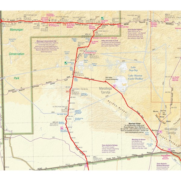
Voakes Hill to
Cook is a route that you can get a permit for from
Maralinga Tjarutja Lands.
From
Cook you can go via
Knowles Cave to
Nullarbor Roadhouse which is a great drive across the "real Nullarbor".
https://www.youtube.com/watch?v=ebA-10AgL6s
People also get permits occasionally to turn left onto the Aboriginal Business Road and drive to
Maralinga Village if they are booked on a
Maralinga bomb site tour (which I would highly recommend). This is a good road.
From there south, you can go via
Watson and the "real Nullarbor" again (with a permit to transit
Yalata land), or via
Ooldea to Colona on the highway. This route is mostly bitumen.
You will NOT get a permit to follow the Trans Australia Railway to meet up with the northern end of
Googs Track.
We know this country reasonably
well.
Cheers,
Peter
OKA196 motorhome.
AnswerID:
645672
Follow Up By: Peter_n_Margaret - Tuesday, Apr 16, 2024 at 13:22
Tuesday, Apr 16, 2024 at 13:22
If you come south from
Voakes Hill Corner, be aware that about 10 years ago (+/-) there was a realignment of the track that is not shown on most maps.
This has confused some people we have met because they think that they are lost as a result of travelling west instead of the expected south west on the maps they have.
The old section is closed both ends and is becoming overgrown.
The realignment is a significantly better road than the one it replaced.

GVD tracks

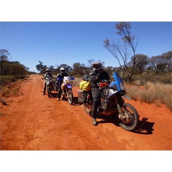
Worried motorcyclists with low fuel on the realignment.

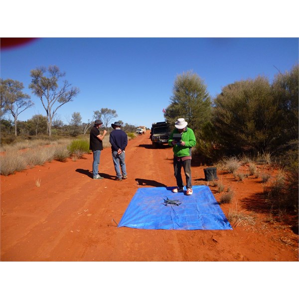
Friends of the Great Victoria Desert doing vegetation surveys on the re-aligned road.
Cheers,
Peter
OKA196 motorhome
FollowupID:
926009
Follow Up By: Member - Charlie C - Wednesday, Apr 17, 2024 at 09:37
Wednesday, Apr 17, 2024 at 09:37
Thanks Peter, thats great info all round. The videos are great and give a good idea of the country you're travelling through. I guess it will be up to a decision on going south at
Voakes Hill, or continuing to Cooper Pedy and maybe doing Goog's later.
FollowupID:
926018
Follow Up By: Peter_n_Margaret - Wednesday, Apr 17, 2024 at 10:01
Wednesday, Apr 17, 2024 at 10:01
There are good reasons for each alternative Charlie.
If seeing the "real Nullarbor" is high on your agenda, you need to head south before the
Ooldea-Colona alternative. ie via
Watson or
Cook-
Knowles Cave.
Cook is worth a good look around.
Googs is a great drive too of course and there are good meals and an evening
camp fire at the
Kingoonya pub.
Cheers,
Peter
OKA196 motorhome
FollowupID:
926019
Follow Up By: Allan B (Sunshine Coast) - Wednesday, Apr 17, 2024 at 17:30
Wednesday, Apr 17, 2024 at 17:30
.
Hi Charlie,
An alternative is to travel south from the Anne Beadell as suggested above, then continue on to the Eyre Hwy and head east to exit onto
Googs Track, Then through
Kingoonya to
Coober Pedy.
Parks SA prefer the direction of travel on Googs south to north in order to avoid confrontations with other vehicles and they discourage trailers.
Note that Googs has a number of dunes, some of which can be soft and challenging. Drop your tyre pressures to below 20psi. I always used 18psi and had no trouble in a Troopy.
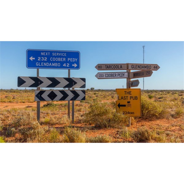
The turnoff to Googs from the Eyre Hwy is not boldly marked. Look for the roadsigns pictured below. Although I seem to remember another turnoff more wester, but even less clearly signed, if at all.

Googs Track turnoff.
FollowupID:
926020
Reply By: IvanTheTerrible - Monday, Apr 15, 2024 at 21:48
Monday, Apr 15, 2024 at 21:48
The two tracks are no were near connected. If you go down through
Cook you'll miss the most interesting part of the
Anne Beadell Highway. I personally would go to Cobber Pedy and then down to
Kingoonya. Then head west onto Googs
AnswerID:
645673
Follow Up By: IvanTheTerrible - Tuesday, Apr 16, 2024 at 19:40
Tuesday, Apr 16, 2024 at 19:40
And? I'm not watching it and I dont see the relevance
FollowupID:
926010
Reply By: Member - Graeme C13 - Tuesday, Apr 16, 2024 at 19:48
Tuesday, Apr 16, 2024 at 19:48
Hi Charlie, doing this trip East to West during this May. Happy to update you on return early June.
AnswerID:
645678
Follow Up By: Member - Charlie C - Wednesday, Apr 17, 2024 at 09:35
Wednesday, Apr 17, 2024 at 09:35
Cheers Graeme, would love to hear about it.
FollowupID:
926017
Follow Up By: NichBails - Saturday, Apr 20, 2024 at 18:34
Saturday, Apr 20, 2024 at 18:34
We were hoping to do the same in may but it’s closed due to floods - may not be opened until end of may.
FollowupID:
926042
Reply By: Member - Boobook - Wednesday, Apr 17, 2024 at 06:28
Wednesday, Apr 17, 2024 at 06:28
Your best bet is to complete the ABH then restock refresh in
Coober Pedy, go down to
Kingoonya then
Tarcoola and then down Googs.
It you turn off the ABH too soon from the west, you miss all the best parts. Also,
Tarcoola is a hoot. ( koke intended)
AnswerID:
645683